NDVI Analysis
Normalized Difference Vegetation Index from Sentinel-2 satellite imagery.
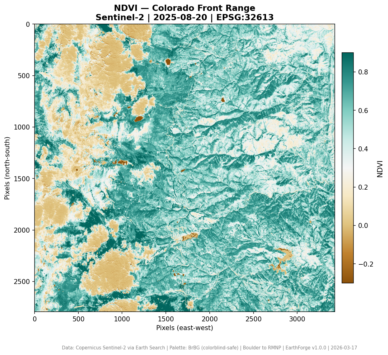
Colorado Front Range
Shows the vegetation gradient from plains to alpine tundra.
Run it:
What it demonstrates: - STAC search with cloud cover filtering - Windowed reads from remote COGs (no full download) - CRS reprojection for bounding box queries - BrBG colorblind-safe diverging palette
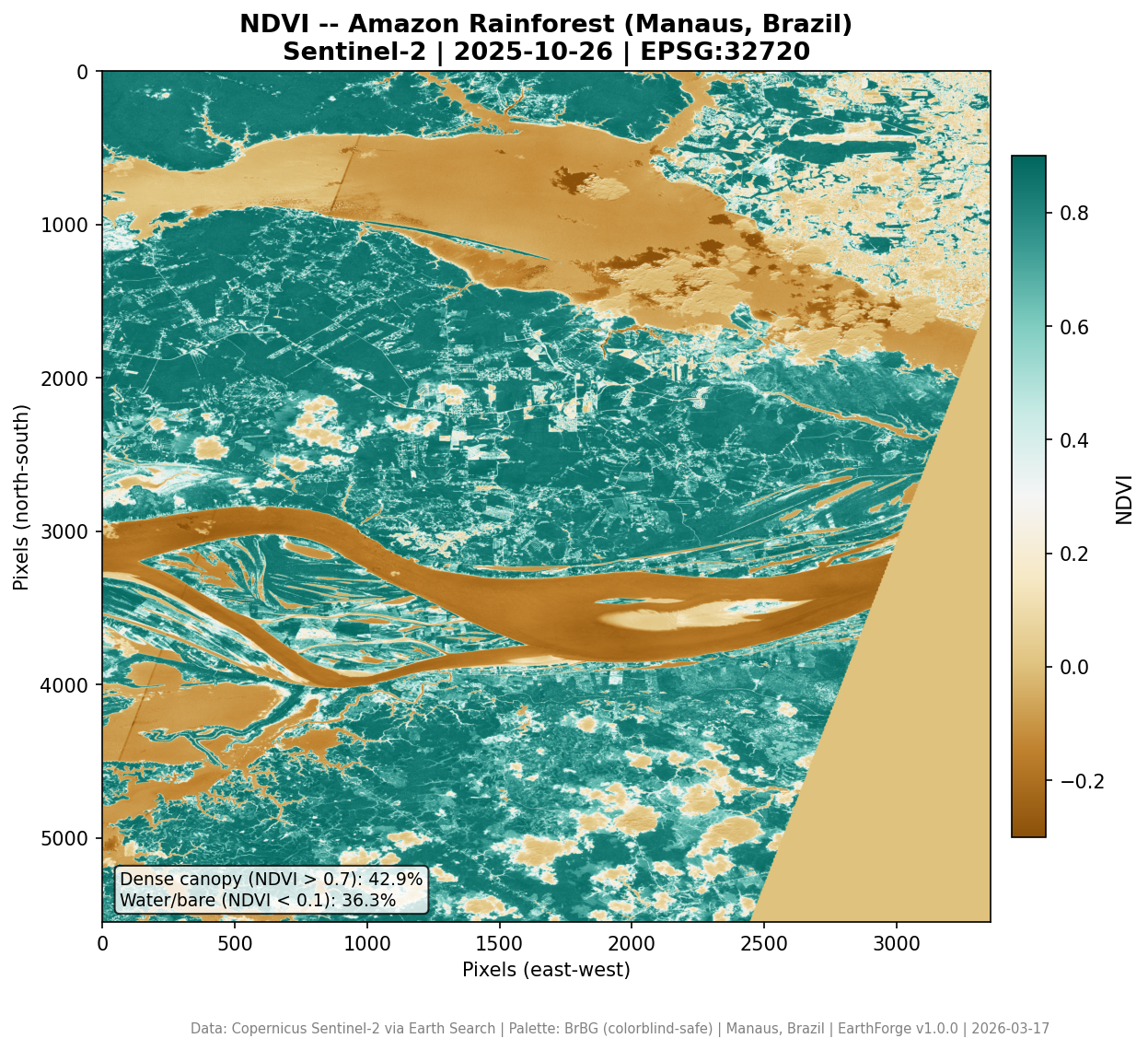
Amazon Rainforest
Dense tropical canopy near Manaus, Brazil.
Run it:
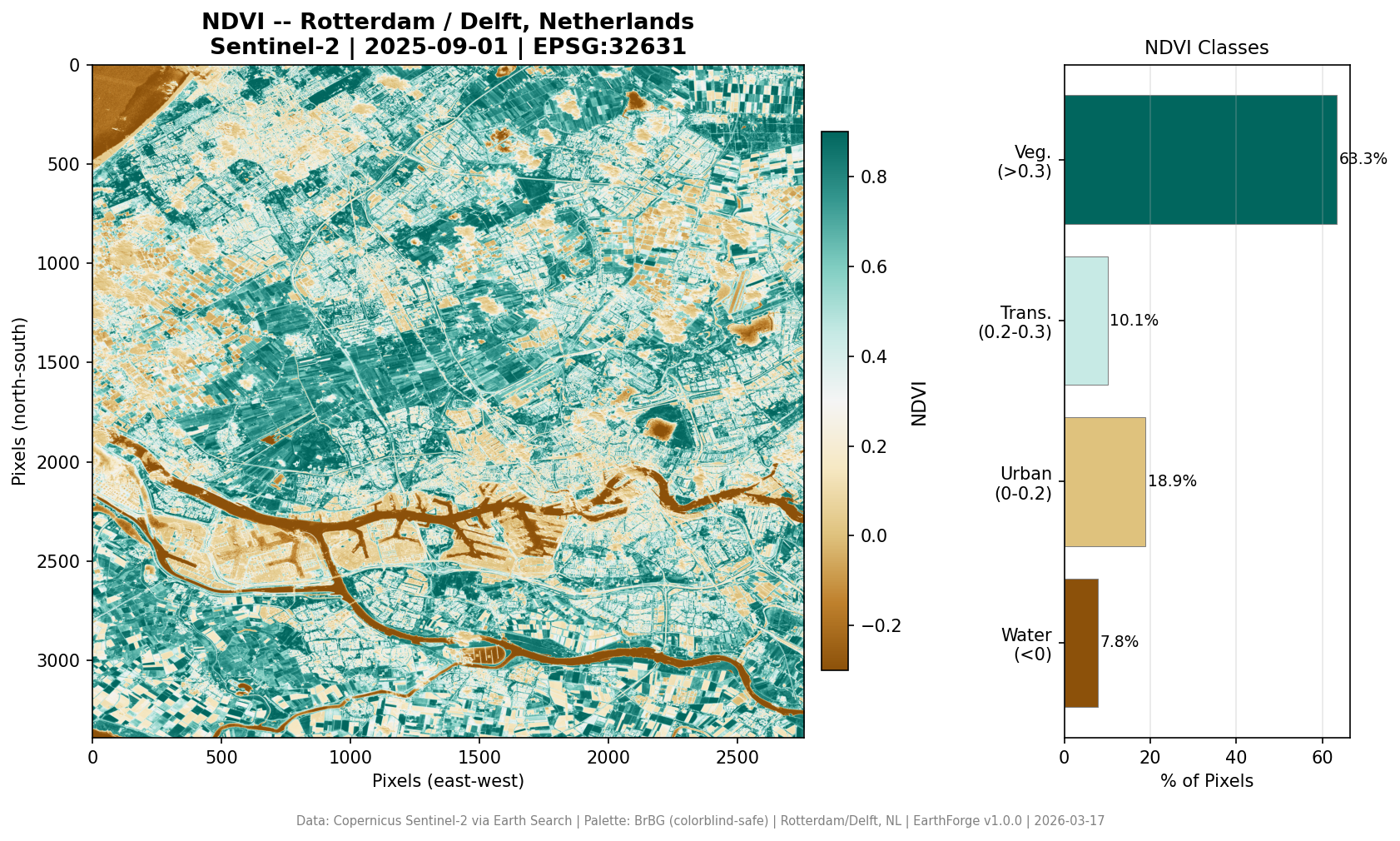
Netherlands — Rotterdam/Delft
Urban, water, and agricultural land use classification by NDVI.
Run it:
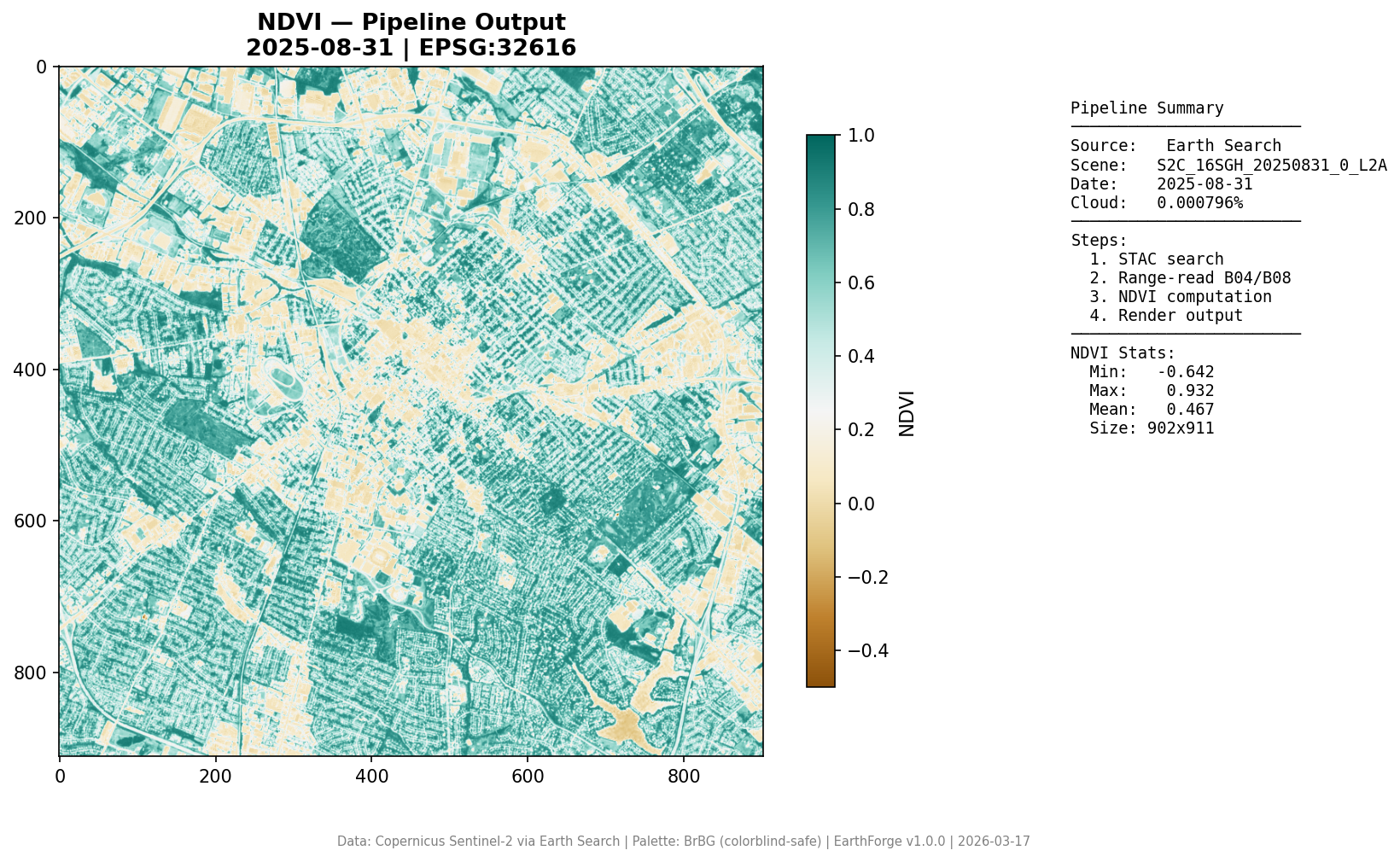
Pipeline Workflow
Automated STAC-to-NDVI pipeline using the expression evaluator.
Run it:
Pipeline steps:
1. STAC search for clear Sentinel-2 scene
2. Range-read B04 (red) and B08 (NIR) bands
3. Compute NDVI via safe expression evaluator: (B08 - B04) / (B08 + B04)
4. Render with BrBG palette + pipeline summary sidebar