DEM & Terrain Analysis
Elevation data from Copernicus DEM, SRTM, and OpenTopography.
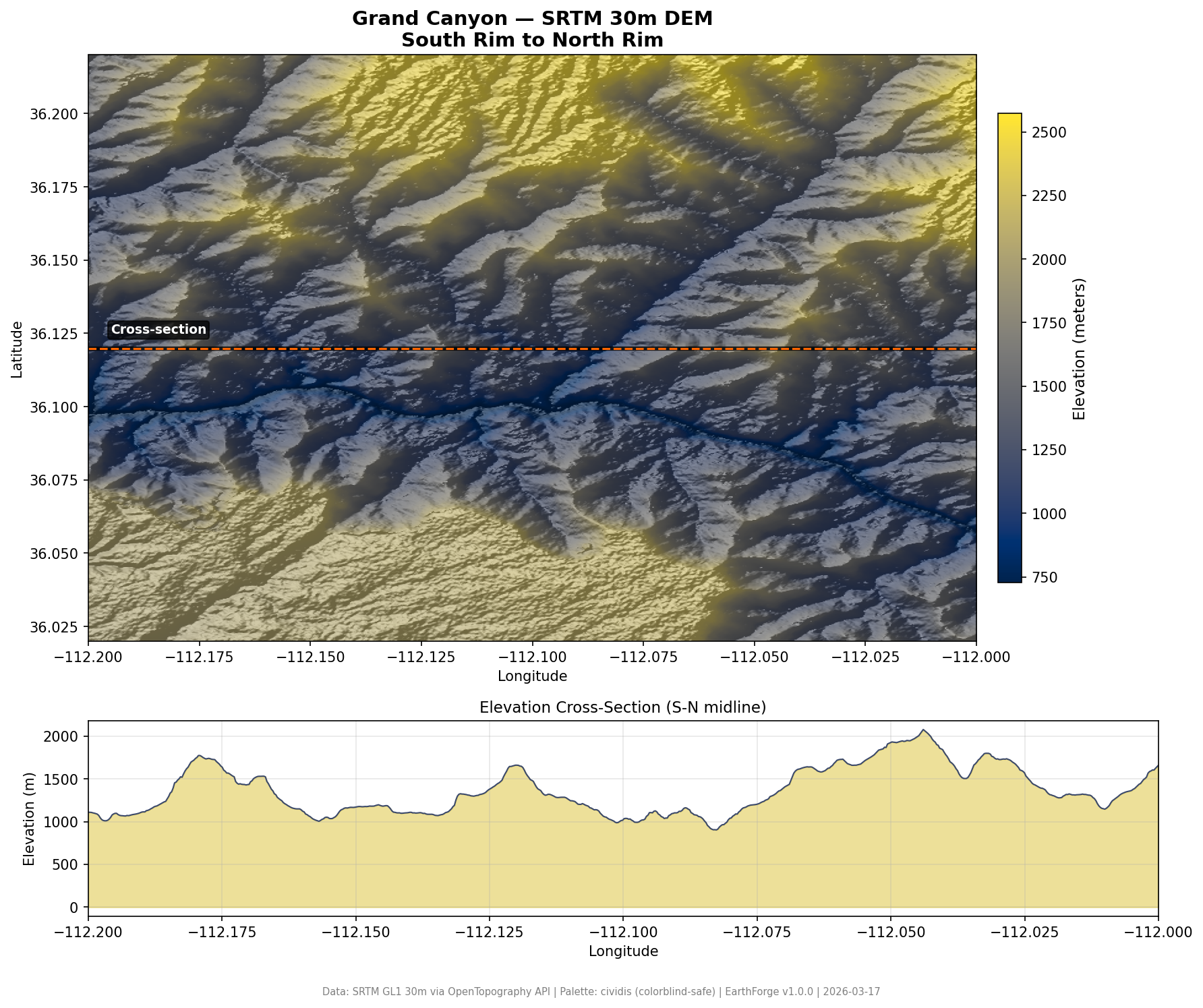
Grand Canyon
1,844m of relief from the Colorado River to the rim.
Run it:
What it demonstrates: - OpenTopography API integration (SRTM GL1 30m) - Hillshade computation with configurable sun position - Elevation cross-section profile - High-contrast annotation lines (WCAG 2.1 AA)
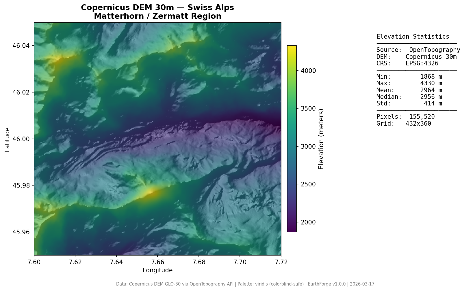
Swiss Alps — Matterhorn
Alpine terrain from Copernicus DEM 30m with statistics sidebar.
Run it:
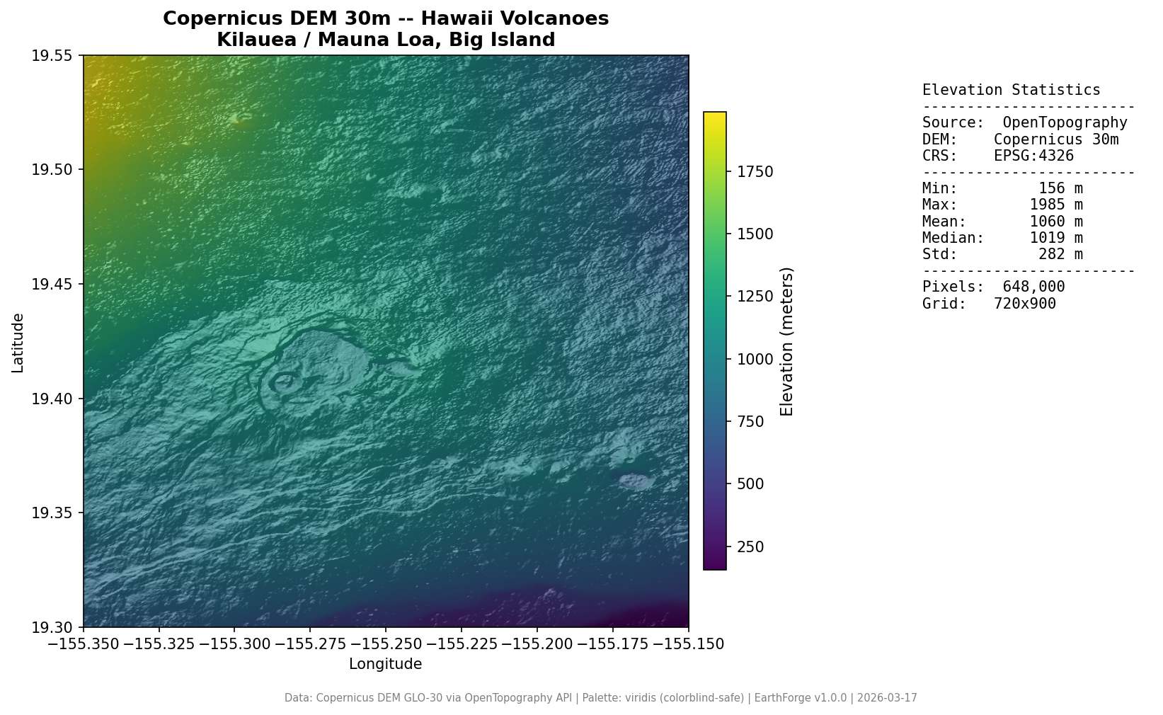
Hawaii Volcanoes
Kilauea and Mauna Loa volcanic terrain.
Run it:
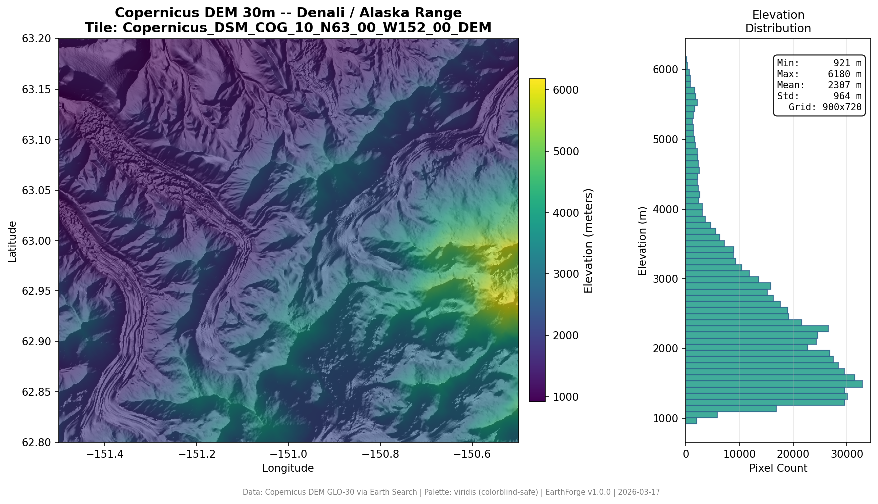
Denali, Alaska — DEM Statistics
Elevation histogram and statistics from the Alaska Range.
Run it: